Political Map
This map shows the political boundaries in Western Europe
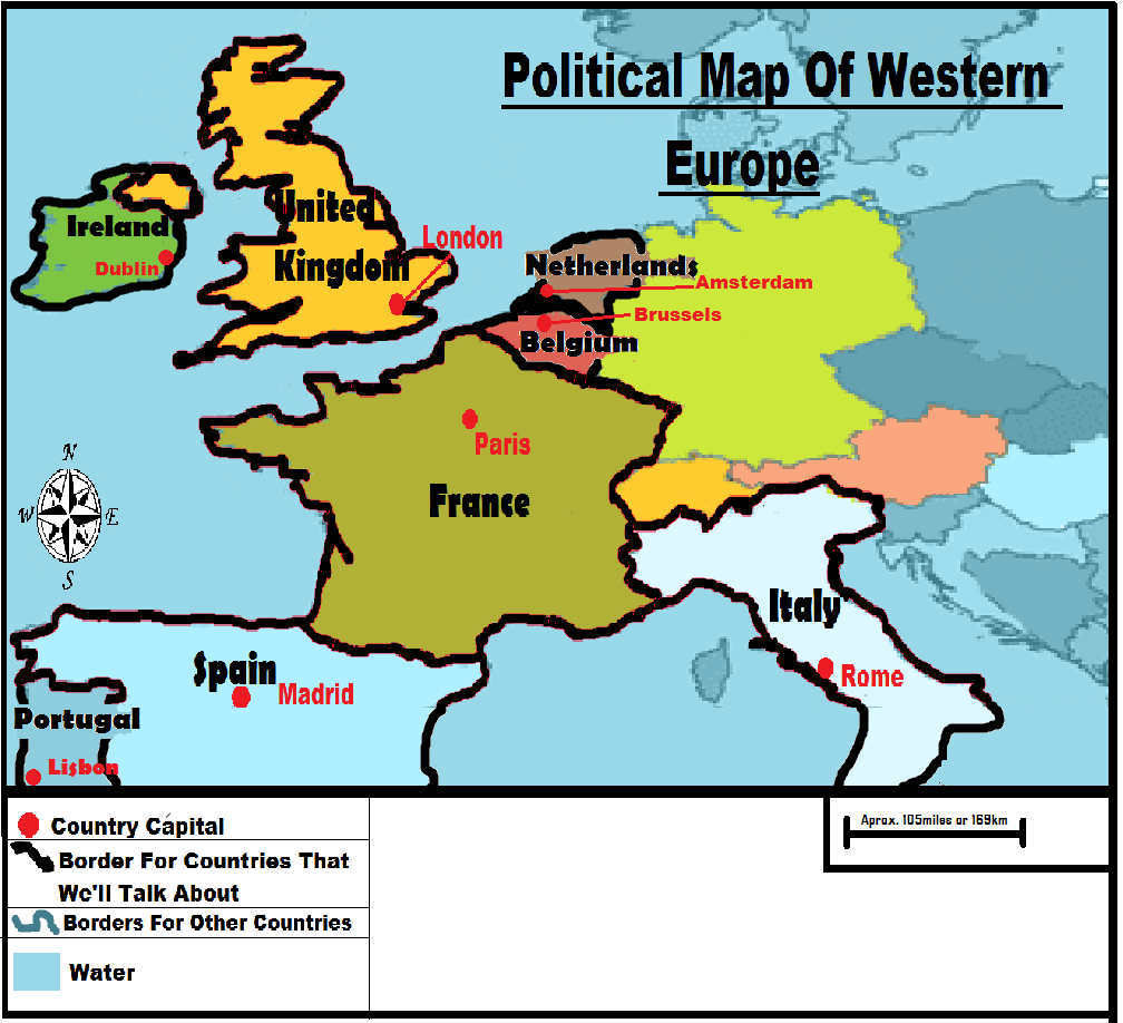
The boundaries of the United Kingdom was formed when England and Scotland unified their kingdoms together in 1707, hence the name “united kingdom” get it? France first became a republic after their French Revolution in 1789-1799. In 1492, Spain became a country when the Emirate of Granada was seized by Spanish forces. Portugal was born as a result of the Christian Reconquista (a period of time when the Iberian Peninsula spanned and the fall of the last Islamic state in Iberia at Granada), and in 1139, Alfonso Henriques was proclaimed King of Portugal, which establish the independence of Portuguese. According to a Roman myth, Italy was founded on 21 April 753 BC by twin brothers Romulus and Remus, who came from the Trojan Prince Aeneas and who were grandsons of the Latin King, Numitor of Alba Longa. The Irish Boundary Commission was “assignment” that was met to decide the official, actual line of the border between the Irish Free State and Northern Ireland in 1924-1925. Netherlands gained their independence in 1581 with the Act of Abjuration. And Belgium separated from northern Netherlands and declared their independence in 1830.
The Physical Map
This map show the physical features of Western Europe.
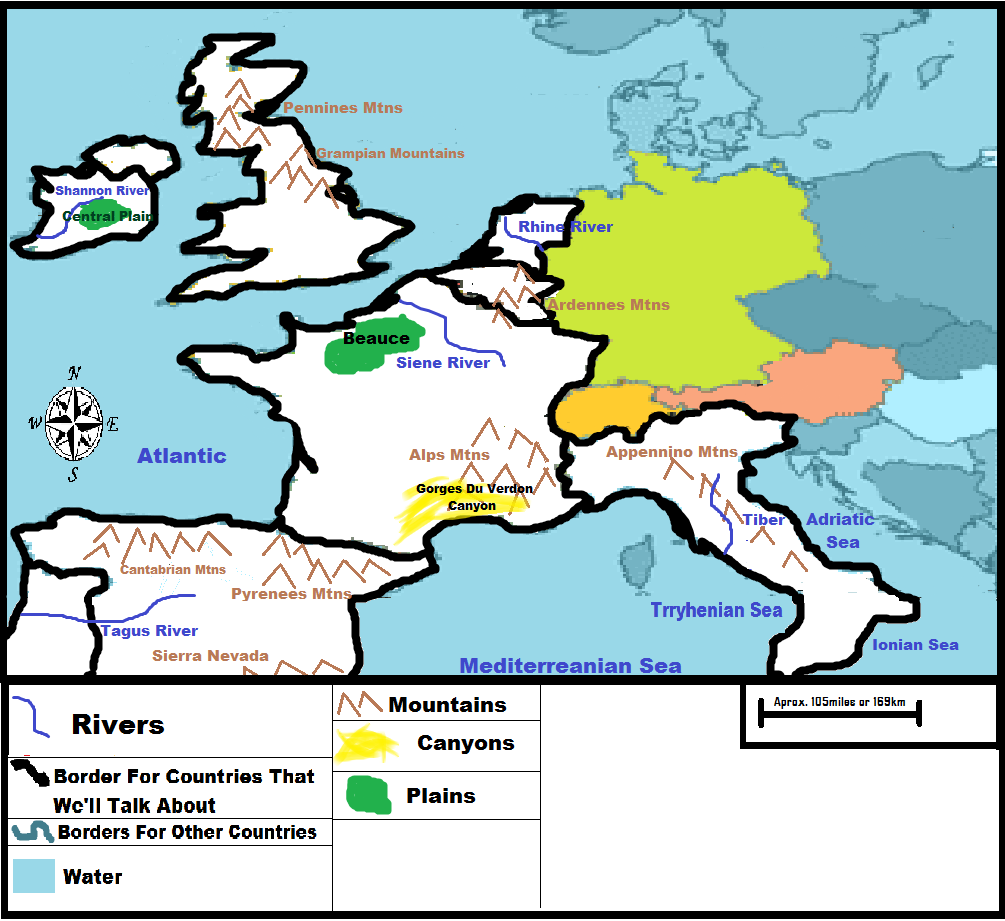
Apennines form the physical backbone of peninsular Italy. Since a long time ago and still now, the Apennines have been home to many Italians. Today, the highest village settlement is found at about 4,500 to 5,000 feet above sea level. Most of the population is found in the wide river valleys, which are rich in alluvial and cultivated land. Tiber is the 3rd largest river in Italy. The Tiber goes the Apennines and connects with the Aniene River. The city of Rome (Capital of Italy) was founded near the banks of Tiber. The Alps are the largest mountain range in all Europe, and its highest point is Mount Blanc. The Seine River is one of the biggest and most recognizable rivers in France. In Spain, the Pyrenees Mountains form a barrier between Spain and France. Sierra Nevada (which means snow covered mountain range) is another mountain range that has a national park in Spain and also has Mulhacen, the highest mountain in Spain. Of the five main rivers in Spain, the Tajo, Duero, Guadiana and Guadalquivir all flow southwards and westwards out into the Atlantic ocean, whereas the Ebro flow to the Mediterranean Sea. River Shannon is the longest river in Ireland. The Gorges Du Verdon, in southeast France, is a canyon that is often considered to be one of Europe's most gorgeous canyon.
